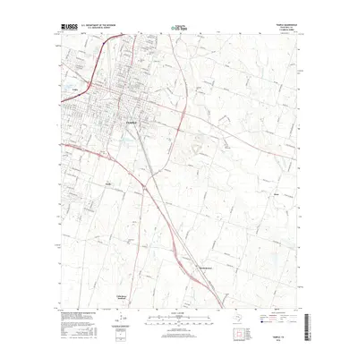
2016 Map of Temple
USGS Topo · Published 2016About this map
The city of Temple serves as the central hub of this Bell County landscape, where the urban grid intersects with numerous radiating creeks and rural communities. In the mid-2010s, the area exhibits a dense network of suburban and rural roads connecting smaller settlements like Heidenheimer, Gober, Smith, and Little River-Academy. The map captures a high concentration of local history markers, particularly cemeteries such as Evergreen Cem, Hillcrest Cem, and Lancaster Cem, which are scattered throughout the northern and eastern reaches of the city. Education and institutional presence are prominent at Temple College and near Veterans Administration Lake. To the southeast, the terrain transitions into agricultural land defined by watercourses like Knob Creek, Boggy Creek, and the Little River, which winds through the southern portion of the quadrangle near Little River-Academy.
Find a feature on this map
148 named features on this map. Tap any name to fly to it.
Don’t see what you’re looking for? This feature index may not catch every label — zoom into the map to look around manually.
Map Details
Editions of this 2016 Temple Map
This is the sole edition of this map. No revisions or reprints were ever made.
Other maps of this area

1885 · Taylor
USGS Topo · 1:125,000

1887 · Taylor
USGS Topo · 1:125,000

1892 · Temple
USGS Topo · 1:125,000

1894 · Taylor
USGS Topo · 1:125,000

1924 · Temple 3-C
USGS Topo · 1:48,000

1924 · Temple 3-B
USGS Topo · 1:48,000

1931 · Belton
USGS Topo · 1:62,500

1954 · Waco
USGS Topo · 1:250,000

1954 · Austin
USGS Topo · 1:250,000

1955 · Waco
USGS Topo · 1:250,000