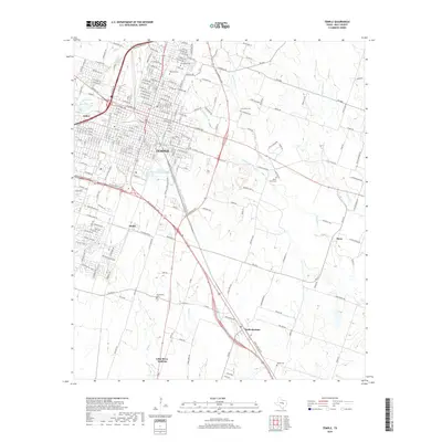
2019 Map of Temple
USGS Topo · Published 2019About this map
Temple serves as the central urban hub of Bell County, anchored by its extensive municipal street grid and the notable Veterans Administration Lake. The surrounding landscape is defined by the convergence of several waterways, including Boggy Cr and Little Elm Cr, which influence the layout of smaller satellite communities. To the southeast, the small town of Heidenheimer and the dual-settlement Little River-Academy highlight the area's ongoing expansion beyond the main city center. Genealogists and local historians will find significant value in the distribution of regional burial grounds, ranging from large urban sites like Hillcrest Cem and Evergreen Cem to more secluded rural locations such as Lancaster Cem and Little Flock Cem. This 2019 survey documents the modern arterial roads and rural routes that connect these long-standing communities across the central Texas plains.
Find a feature on this map
169 named features on this map. Tap any name to fly to it.
Don’t see what you’re looking for? This feature index may not catch every label — zoom into the map to look around manually.
Map Details
Editions of this 2019 Temple Map
This is the sole edition of this map. No revisions or reprints were ever made.
Other maps of this area

1885 · Taylor
USGS Topo · 1:125,000

1887 · Taylor
USGS Topo · 1:125,000

1892 · Temple
USGS Topo · 1:125,000

1894 · Taylor
USGS Topo · 1:125,000

1924 · Temple 3-C
USGS Topo · 1:48,000

1924 · Temple 3-B
USGS Topo · 1:48,000

1931 · Belton
USGS Topo · 1:62,500

1954 · Waco
USGS Topo · 1:250,000

1954 · Austin
USGS Topo · 1:250,000

1955 · Waco
USGS Topo · 1:250,000