
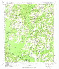
1949 Map of Tennessee Colony
USGS Topo · Published 1967About this map
Tennessee Colony and Cayuga anchor this late 1940s landscape, where the agricultural traditions of Anderson County meet the industrial footprint of the Blackfoot Oil Field. The Trinity River forms a dominant natural boundary to the west, its floodplain punctuated by numerous oxbows and backwaters including Cook Lake, Weed Lake, and Patterson Lake. This environment supported a dense network of rural social institutions, evidenced by the many small churches and schools such as Trinity Chapel Sch, Freewill Ch, and New Bethel Ch. The presence of several family and community burial grounds, including Judson Cem and Liberty Cem, offers significant detail for those tracing local lineages. Along the river, landmarks like Greens Bluff and the site of Tyler Ferry Lake indicate the historical importance of the waterway for transport and local orientation before the widespread modernization of the road network.
Find a feature on this map
63 named features on this map. Tap any name to fly to it.
Don’t see what you’re looking for? This feature index may not catch every label — zoom into the map to look around manually.
Map Details
Editions of this 1949 Tennessee Colony Map
2 editions found
Other maps of this area

1919 · Fairfield
USGS Topo · 1:62,500

1949 · Palestine
USGS Topo · 1:62,500

1949 · Frankston
USGS Topo · 1:62,500

1949 · Athens
USGS Topo · 1:62,500

1950 · Athens
USGS Topo · 1:62,500

1950 · Palestine
USGS Topo · 1:62,500

1950 · Frankston
USGS Topo · 1:62,500

1950 · Tennessee Colony
USGS Topo · 1:62,500

1951 · Elkhart
USGS Topo · 1:62,500

1953 · Palestine
USGS Topo · 1:250,000