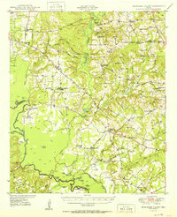
1950 Map of Tennessee Colony
USGS Topo · Published 1950About this map
Cayuga Oil Field and the Blackfoot Oil Field dominate the northern landscape of this survey, highlighting the mid-century petroleum economy of the Anderson and Freestone county border. Along the Trinity River, a complex system of oxbow lakes and bottomlands includes Tyler Ferry Lake and Mossy Lake, indicating the shifting course of the river over time.
Find a feature on this map
75 named features on this map. Tap any name to fly to it.
Don’t see what you’re looking for? This feature index may not catch every label — zoom into the map to look around manually.
Map Details
Editions of this 1950 Tennessee Colony Map
2 editions found
Other maps of this area

1919 · Fairfield
USGS Topo · 1:62,500

1949 · Palestine
USGS Topo · 1:62,500

1949 · Frankston
USGS Topo · 1:62,500

1949 · Athens
USGS Topo · 1:62,500

1949 · Tennessee Colony
USGS Topo · 1:62,500

1950 · Athens
USGS Topo · 1:62,500

1950 · Palestine
USGS Topo · 1:62,500

1950 · Frankston
USGS Topo · 1:62,500

1950 · Tennessee Colony
USGS Topo · 1:62,500

1951 · Elkhart
USGS Topo · 1:62,500