
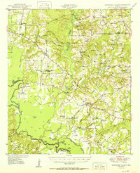
1950 Map of Tennessee Colony
USGS Topo · Published 1950About this map
The Trinity River defines the western edge of this East Texas landscape, where the meandering waterway creates a complex network of oxbows and bottomland features like Snag Lake and Flag Lake. This mid-century survey illustrates a rural economy transitioning from traditional river crossings like Tyler Ferry toward industrial development, most notably at the Cayuga Field and Blackfoot Oil Field. The area is characterized by a high density of community centers, schools, and churches that served scattered homesteads, including Tennessee Colony and Cayuga. Genealogists will find a wealth of specific local landmarks, from the Judson Cem and Liberty Cem to various rural educational sites such as Bethel Sch No 2 and Yard Sch. Several flowing wells and named creeks, including Catfish Creek and Keechie Creek, weave through the terrain, indicating a well-watered region critical for both the agriculture and the emerging petroleum industry of the late 1940s.
Find a feature on this map
70 named features on this map. Tap any name to fly to it.
Don’t see what you’re looking for? This feature index may not catch every label — zoom into the map to look around manually.
Map Details
Editions of this 1950 Tennessee Colony Map
2 editions found
Other maps of this area

1919 · Fairfield
USGS Topo · 1:62,500

1949 · Palestine
USGS Topo · 1:62,500

1949 · Frankston
USGS Topo · 1:62,500

1949 · Athens
USGS Topo · 1:62,500

1949 · Tennessee Colony
USGS Topo · 1:62,500

1950 · Athens
USGS Topo · 1:62,500

1950 · Palestine
USGS Topo · 1:62,500

1950 · Frankston
USGS Topo · 1:62,500

1951 · Elkhart
USGS Topo · 1:62,500

1953 · Palestine
USGS Topo · 1:250,000