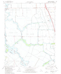
1978 Map of Terminous
USGS Topo · Published 1978About this map
The Terminous Tract and its surrounding delta lands define this 1978 landscape, where intricate waterways carve through fertile island tracts. The settlement of Terminous sits at the confluence of the Mokelumne River and Potato Slough, serving as a hub for the region's agricultural and maritime activities. Transport infrastructure is prominent, from the Stockton Deep Water Channel that facilitates heavy shipping to the Thornton Road corridor, which shows segments under construction during this period. Local education is anchored by the Venice King Sch, while the South Spud Island Recreation Area and Paradise Point reflect the area's transition into a destination for water-based leisure. This survey provides a clear look at the sophisticated pumping and drainage systems required to manage tracts like the Shin Kee Tract and Rindge Tract.
Find a feature on this map
66 named features on this map. Tap any name to fly to it.
Don’t see what you’re looking for? This feature index may not catch every label — zoom into the map to look around manually.
Map Details
Editions of this 1978 Terminous Map
2 editions found
Other maps of this area

1894 · Lodi
USGS Topo · 1:125,000

1910 · New Hope
USGS Topo · 1:31,680

1910 · Castle
USGS Topo · 1:31,680

1910 · Bouldin
USGS Topo · 1:31,680

1910 · Woodbridge
USGS Topo · 1:31,680

1910 · Headreach
USGS Topo · 1:31,680

1910 · Isleton
USGS Topo · 1:31,680

1913 · Woodward Island
USGS Topo · 1:31,680

1913 · Stockton
USGS Topo · 1:31,680

1913 · Holt
USGS Topo · 1:31,680