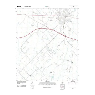
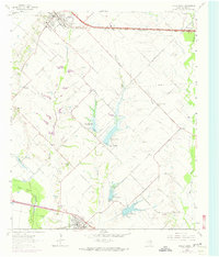
2010 Map of Terrell South
USGS Topo · Published 2010About this map
Terrell anchor this region where the Blackland Prairie begins to transition into the East Texas post oak belt. The landscape is defined by the drainage networks of Bachelor Creek, Kings Creek, and Little Brushy Creek, which carve through the rural terrain south of the city. While the northern section shows the urban expansion of Terrell and its transportation corridors like State Spur 557, the southern half remains a patchwork of agricultural lands and small communities including Union Valley, Post Oak Bend, and Lone Star. Genealogists will find a high density of burial grounds throughout this survey, from large municipal sites like Oakwood Cemetery and Barrow Cemetery to more remote locations such as Rose Hill Cemetery and the East Bachelor Cemeteries. The presence of both the Terrell Municipal Airport and the Flying G Airport underscores the importance of aviation to this part of Kaufman County.
Find a feature on this map
63 named features on this map. Tap any name to fly to it.
Don’t see what you’re looking for? This feature index may not catch every label — zoom into the map to look around manually.
Map Details
Editions of this 2010 Terrell South Map
This is the sole edition of this map. No revisions or reprints were ever made.
Other maps of this area

1919 · Royse City
USGS Topo · 1:62,500

1954 · Dallas
USGS Topo · 1:250,000

1956 · Kaufman
USGS Topo · 1:62,500

1956 · Quinlan
USGS Topo · 1:62,500

1958 · Dallas
USGS Topo · 1:250,000

1962 · Elmo
USGS Topo · 1:24,000
1962 · Ola
USGS Topo · 1:24,000
1962 · Scurry
USGS Topo · 1:24,000
1962 · Terrell North
USGS Topo · 1:24,000
1963 · Forney South
USGS Topo · 1:24,000