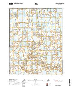
2020 Map of Teshekpuk B-2 NW
USGS Topo · Published 2020About this map
The North Slope's hydrological complexity is on full display in this 2020 survey, dominated by the intricate network of water bodies leading toward the northwestern reaches of Teshekpuk Lake. This landscape is defined by its saturated terrain, where an endless series of thaw lakes and ponds create a labyrinthine pattern across the Arctic coastal plain. The map provides a precise look at the township and range lines, specifically T13n R9w, T13n R8w, T12n R9w, and T12n R8w, which serve as the primary markers in this uninhabited expanse. Without settlements or roads, the topography focuses entirely on the natural drainage and the shifting margins of the water, offering an essential view of the region's environmental character as it appeared in the early 21st century.
Find a feature on this map
5 named features on this map. Tap any name to fly to it.
Don’t see what you’re looking for? This feature index may not catch every label — zoom into the map to look around manually.
Map Details
Editions of this 2020 Teshekpuk B-2 NW Map
This is the sole edition of this map. No revisions or reprints were ever made.
Other maps of this area

1951 · Teshekpuk
USGS Topo · 1:250,000

1955 · Teshekpuk
USGS Topo · 1:250,000
1955 · Teshekpuk B-3
USGS Topo · 1:63,360

1955 · Teshekpuk C-3
USGS Topo · 1:63,360
1955 · Teshekpuk B-2
USGS Topo · 1:63,360
1955 · Teshekpuk C-2
USGS Topo · 1:63,360
1962 · Teshekpuk C-2
USGS Topo · 1:50,000

1964 · Teshekpuk
USGS Topo · 1:250,000
1982 · Teshekpuk B-2
USGS Topo · 1:63,360
2013 · Teshekpuk C-3 SE
USGS Topo · 1:25,000