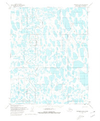
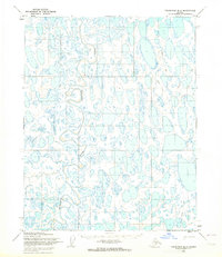
1955 Map of Teshekpuk B-5
USGS Topo · Published 1980About this map
Topagoruk River winds through the North Slope of Alaska in this 1955 survey of the Teshekpuk region. This landscape, situated entirely within the National Petroleum Reserve in Alaska, is characterized by a dense network of thaw lakes and wetlands, where survey points like Lue, Topa, and Clay mark subtle elevations in the low-lying terrain. The isolation of the Arctic coastal plain is evident in the lack of permanent infrastructure, with the notable exception of a seasonal Tractor Trail cutting through the eastern portion of the sheet. This route served as a vital terrestrial link for exploration and supply transport before more modern logistics reached these remote northern latitudes. The mapping represents a moment of transition for the North Slope, documenting the region through photogrammetric methods from aerial photographs taken during the mid-fifties.
Find a feature on this map
7 named features on this map. Tap any name to fly to it.
Don’t see what you’re looking for? This feature index may not catch every label — zoom into the map to look around manually.
Map Details
Editions of this 1955 Teshekpuk B-5 Map
2 editions found
Other maps of this area

1951 · Meade River
USGS Topo · 1:250,000

1951 · Teshekpuk
USGS Topo · 1:250,000

1955 · Teshekpuk
USGS Topo · 1:250,000
1955 · Teshekpuk B-4
USGS Topo · 1:63,360

1955 · Teshekpuk C-5
USGS Topo · 1:63,360

1955 · Teshekpuk C-4
USGS Topo · 1:63,360
1955 · Teshekpuk A-5
USGS Topo · 1:63,360
1955 · Teshekpuk A-4
USGS Topo · 1:63,360
1955 · Teshekpuk B-5
USGS Topo · 1:63,360

1955 · Meade River
USGS Topo · 1:250,000