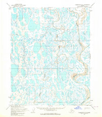
1955 Map of Teshekpuk B-4
USGS Topo · Published 1964About this map
Naval Petroleum Reserve No. 4 encompasses this entire Arctic landscape, a vast expanse of water and tundra surveyed in the mid-1950s. The region is defined by the complex, meandering paths of the Ikpikpuk River, which dominates the eastern portion of the map, alongside the Chipp River and the Oumalik River. These slow-moving waterways wind through a dense network of countless small lakes and ponds, illustrating the saturated, low-relief geography of Alaska's North Slope.
Find a feature on this map
5 named features on this map. Tap any name to fly to it.
Don’t see what you’re looking for? This feature index may not catch every label — zoom into the map to look around manually.
Map Details
Editions of this 1955 Teshekpuk B-4 Map
2 editions found
Other maps of this area

1951 · Teshekpuk
USGS Topo · 1:250,000

1955 · Teshekpuk
USGS Topo · 1:250,000
1955 · Teshekpuk A-3
USGS Topo · 1:63,360
1955 · Teshekpuk B-3
USGS Topo · 1:63,360

1955 · Teshekpuk C-3
USGS Topo · 1:63,360

1955 · Teshekpuk C-5
USGS Topo · 1:63,360

1955 · Teshekpuk C-4
USGS Topo · 1:63,360
1955 · Teshekpuk A-5
USGS Topo · 1:63,360
1955 · Teshekpuk A-4
USGS Topo · 1:63,360
1955 · Teshekpuk B-5
USGS Topo · 1:63,360