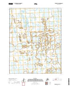
2020 Map of Teshekpuk C-5 NW
USGS Topo · Published 2020About this map
Topagoruk River meanders across this Arctic coastal plain in the North Slope Borough, carving a complex network of oxbows and seasonal channels through the saturated tundra. The landscape is dominated by countless thermokarst lakes and ponded water, characteristic of the permafrost-underlain terrain near the Beaufort Sea coast. In the northwestern corner, the river begins its final approach toward Admiralty Bay, where the freshwater systems meet the brackish inlets of the Arctic Ocean. This 2020 survey by the U.S. Geological Survey documents a wilderness environment defined entirely by its shifting hydrology and lack of permanent human infrastructure, offering a detailed look at the drainage patterns and landforms of one of the most isolated regions in Alaska.
Find a feature on this map
6 named features on this map. Tap any name to fly to it.
Don’t see what you’re looking for? This feature index may not catch every label — zoom into the map to look around manually.
Map Details
Editions of this 2020 Teshekpuk C-5 NW Map
This is the sole edition of this map. No revisions or reprints were ever made.
Other maps of this area

1951 · Meade River
USGS Topo · 1:250,000

1951 · Teshekpuk
USGS Topo · 1:250,000

1955 · Teshekpuk
USGS Topo · 1:250,000

1955 · Teshekpuk C-5
USGS Topo · 1:63,360

1955 · Meade River
USGS Topo · 1:250,000

1955 · Meade River C-1
USGS Topo · 1:63,360
1955 · Teshekpuk D-5
USGS Topo · 1:63,360
1955 · Meade River D-1
USGS Topo · 1:63,360

1964 · Teshekpuk
USGS Topo · 1:250,000
2013 · Teshekpuk C-5 SW
USGS Topo · 1:25,000