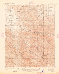
1907 Map of Tesla
USGS Topo · Published 1948About this map
Tesla and Carnegie anchor the eastern canyon landscape of the Diablo Range in this survey based on 1905 fieldwork. This region was a hive of early industrial activity, notably the Pottery works and various mining operations that relied on the Southern Pacific and Western Pacific rail lines to move goods toward the San Joaquin Valley. The map detail captures a specific moment when remote outposts like the Sweet Springs Halfway House served travelers navigating the ridges between the Livermore Valley and the valley floor to the east.
Find a feature on this map
48 named features on this map. Tap any name to fly to it.
Don’t see what you’re looking for? This feature index may not catch every label — zoom into the map to look around manually.
Map Details
Editions of this 1907 Tesla Map
5 editions found
Other maps of this area

1889 · San Jose
USGS Topo · 1:62,500

1896 · Mt. Diablo
USGS Topo · 1:62,500

1897 · San Jose
USGS Topo · 1:62,500

1897 · Mt. Hamilton
USGS Topo · 1:62,500

1898 · Mt. Diablo
USGS Topo · 1:62,500

1899 · San Jose
USGS Topo · 1:62,500

1906 · Pleasanton
USGS Topo · 1:62,500

1907 · Tesla
USGS Topo · 1:62,500

1911 · Byron Hot Springs
USGS Topo · 1:31,680

1914 · Bethany
USGS Topo · 1:31,680