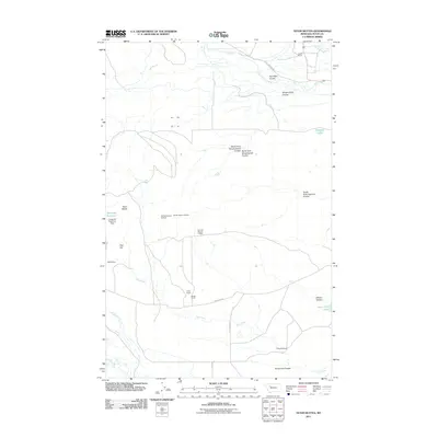
2011 Map of Teton Buttes
USGS Topo · Published 2011About this map
The Teton River carves through the northern reaches of this landscape, flanked by a series of dramatic coulees including Hod Main Coulee and Klingensmith Coulee. This 2011 survey of the Montana plains highlights a land defined by expansive ranching operations and water management, with established homesteads like Knaff Ranch and Greyn Ranch anchoring the local geography. The presence of several small-scale mining operations, such as the SW NW Section 10 Mine and NW NW Section 11 Mine, suggests a continued history of extraction alongside traditional agriculture.
Find a feature on this map
29 named features on this map. Tap any name to fly to it.
Don’t see what you’re looking for? This feature index may not catch every label — zoom into the map to look around manually.
Map Details
Editions of this 2011 Teton Buttes Map
This is the sole edition of this map. No revisions or reprints were ever made.
Other maps of this area

1920 · Choteau
USGS Topo · 1:125,000

1955 · Choteau
USGS Topo · 1:250,000

1957 · Choteau
USGS Topo · 1:250,000

1958 · Choteau
USGS Topo · 1:250,000

1960 · Bynum
USGS Topo · 1:62,500

1960 · Choteau
USGS Topo · 1:62,500

1960 · Gilman
USGS Topo · 1:62,500
1960 · Freezeout Lake
USGS Topo · 1:62,500

1962 · Choteau
USGS Topo · 1:250,000
1976 · Choteau
USGS Topo · 1:250,000