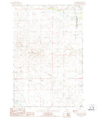
1987 Map of Teton Buttes
USGS Topo · Published 1987About this map
Teton Buttes and Clay Hill define the relief of this Montana landscape, where the Teton River cuts through the northern sections. This 1980s provisional survey shows a working ranching country, documenting family-named holdings such as Knaff Ranch, Greyn Ranch, and Meadows Ranch. The area is characterized by a network of drainage features including Main Coulee, Sevenmile Coulee, and Willow Creek, which feed into the larger river system. A significant portion of the northeastern corner is dedicated to the Teton-Spring Creek Bird Preserve, protecting the habitat around Spring Creek and the Reickoff Lakes. The map also captures the industrial footprint of the era through several marked Gravel Pit sites located near the river and coulee banks.
Find a feature on this map
21 named features on this map. Tap any name to fly to it.
Don’t see what you’re looking for? This feature index may not catch every label — zoom into the map to look around manually.
Map Details
Editions of this 1987 Teton Buttes Map
This is the sole edition of this map. No revisions or reprints were ever made.
Other maps of this area

1920 · Choteau
USGS Topo · 1:125,000

1955 · Choteau
USGS Topo · 1:250,000

1957 · Choteau
USGS Topo · 1:250,000

1958 · Choteau
USGS Topo · 1:250,000

1960 · Bynum
USGS Topo · 1:62,500

1960 · Choteau
USGS Topo · 1:62,500

1960 · Gilman
USGS Topo · 1:62,500
1960 · Freezeout Lake
USGS Topo · 1:62,500

1962 · Choteau
USGS Topo · 1:250,000
1976 · Choteau
USGS Topo · 1:250,000