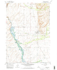
1965 Map of Tetonia
USGS Topo · Published 1980About this map
Teton River meanders through the western half of this Teton County landscape, creating a wide wetland margin as it flows north toward Pinochle Road. This mid-century survey documents the agricultural and transportation framework of the Teton Basin, where the Union Pacific railroad line once connected small grain-stop communities like Tetonia, Felt, and Badger. An Old Railroad Grade branching toward the southwest indicates a shifting transportation network during this era.
Find a feature on this map
25 named features on this map. Tap any name to fly to it.
Don’t see what you’re looking for? This feature index may not catch every label — zoom into the map to look around manually.
Map Details
Editions of this 1965 Tetonia Map
3 editions found
Other maps of this area

1943 · Driggs
USGS Topo · 1:62,500

1943 · Garns Mtn
USGS Topo · 1:62,500

1946 · Driggs
USGS Topo · 1:62,500

1946 · Garns Mtn
USGS Topo · 1:62,500

1955 · Driggs
USGS Topo · 1:250,000

1958 · Driggs
USGS Topo · 1:250,000

1962 · Driggs
USGS Topo · 1:250,000

1965 · Lamont
USGS Topo · 1:24,000

1965 · Packsaddle Lake
USGS Topo · 1:24,000

1965 · Mc Renolds Reservoir
USGS Topo · 1:24,000