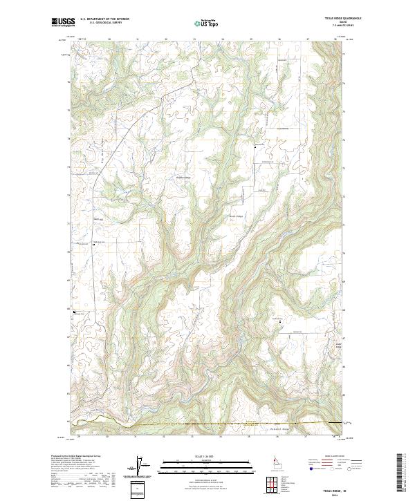
2024 Map of Texas Ridge
USGS Topo · Published 2024About this map
Texas Ridge rises between the deep canyons of the Potlatch River and the rolling uplands of Latah County, defining a landscape of high plateaus and steep drainages. The area is marked by a legacy of rural settlement, evidenced by a high concentration of small family and community burial grounds including Elwood Cem, Wild Rose Cem, and Bethany Cem. These sites, often located near prominent landforms like Huffman Ridge and Bean Hill, suggest the long-standing agricultural and timber foundations of the community. The southern portion of the map follows the winding course of the Potlatch River as it nears the boundary between Latah and Nez Perce counties, where Potlatch Ridge and Cedar Ridge overlook the confluence of smaller tributaries such as Cedar Creek and Rock Creek.
Find a feature on this map
39 named features on this map. Tap any name to fly to it.
Don’t see what you’re looking for? This feature index may not catch every label — zoom into the map to look around manually.
Map Details
Editions of this 2024 Texas Ridge Map
This is the sole edition of this map. No revisions or reprints were ever made.
Other maps of this area

1955 · Pullman
USGS Topo · 1:250,000

1958 · Pullman
USGS Topo · 1:250,000

1961 · Deary
USGS Topo · 1:62,500

1961 · Kendrick
USGS Topo · 1:62,500

1961 · Ahsahka
USGS Topo · 1:62,500

1961 · Bovill
USGS Topo · 1:62,500

1981 · Potlatch
USGS Topo · 1:100,000
1990 · Juliaetta
USGS Topo · 1:24,000
1990 · Stanford
USGS Topo · 1:24,000
1990 · Lenore
USGS Topo · 1:24,000