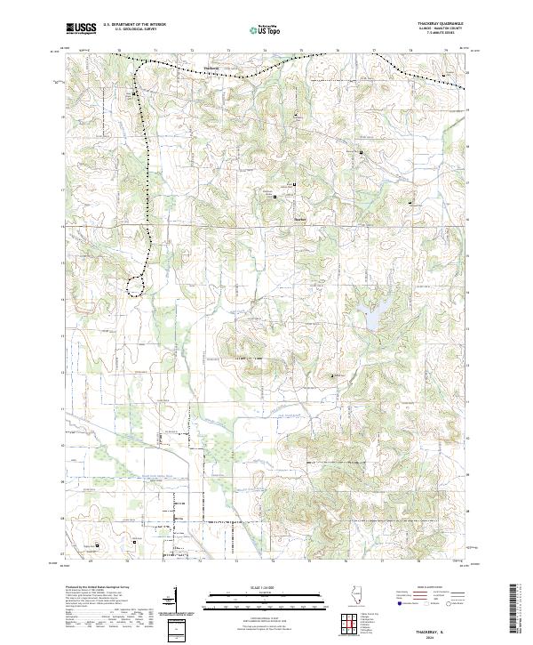
2024 Map of Thackeray
USGS Topo · Published 2024About this map
Thackeray and the small settlement of Thurber anchor this Hamilton County landscape, where agriculture and hydrology define the community structure. The map reveals a high density of rural burial sites, including the Old Brush Harbor Cem and nearby Brush Harbor Cem, which speak to long-standing family lineages in this part of Illinois. The southern portion of the quadrangle is dominated by the North Fork Saline River and its intricate drainage network, featuring Swan Creek, Lick Creek Drain, and Wheeler Creek Drain. A legacy of resource extraction is noted in the northwest near Coal Mine RD, while a web of numbered county roads connects various family-named landmarks like Hopson Cem and Webb Cem across the rural township squares.
Find a feature on this map
69 named features on this map. Tap any name to fly to it.
Don’t see what you’re looking for? This feature index may not catch every label — zoom into the map to look around manually.
Map Details
Editions of this 2024 Thackeray Map
This is the sole edition of this map. No revisions or reprints were ever made.
Other maps of this area

1905 · Eldorado
USGS Topo · 1:62,500

1906 · Eldorado
USGS Topo · 1:62,500

1908 · Galatia
USGS Topo · 1:62,500

1938 · Galatia
USGS Topo · 1:62,500

1941 · Enfield
USGS Topo · 1:62,500

1942 · McLeansboro
USGS Topo · 1:62,500

1944 · Enfield
USGS Topo · 1:62,500

1945 · McLeansboro
USGS Topo · 1:62,500

1949 · Paducah
USGS Topo · 1:250,000

1950 · Paducah
USGS Topo · 1:250,000