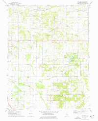
1974 Map of Thackeray
USGS Topo · Published 1977About this map
The Louisville and Nashville railroad corridor defines the northern landscape of this Hamilton County region, connecting the settlement of Thackeray to the surrounding rural countryside. Much of the central terrain is dedicated to the Thackeray Oil Field, where numerous oil wells are scattered across the township sections. This mid-1970s survey captures a transition between heavy resource extraction and public recreation, centered on the Hamilton County State Conservation Area. At the heart of this preserve lies L P Dolan Lake, complete with a boat ramp and several picnic areas near the spillway.
Find a feature on this map
39 named features on this map. Tap any name to fly to it.
Don’t see what you’re looking for? This feature index may not catch every label — zoom into the map to look around manually.
Map Details
Editions of this 1974 Thackeray Map
This is the sole edition of this map. No revisions or reprints were ever made.
Other maps of this area

1905 · Eldorado
USGS Topo · 1:62,500

1906 · Eldorado
USGS Topo · 1:62,500

1908 · Galatia
USGS Topo · 1:62,500

1938 · Galatia
USGS Topo · 1:62,500

1941 · Enfield
USGS Topo · 1:62,500

1942 · McLeansboro
USGS Topo · 1:62,500

1944 · Enfield
USGS Topo · 1:62,500

1945 · McLeansboro
USGS Topo · 1:62,500

1949 · Paducah
USGS Topo · 1:250,000

1950 · Paducah
USGS Topo · 1:250,000