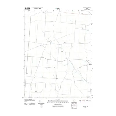
2010 Map of Thackery
USGS Topo · Published 2010About this map
Thackery and the neighboring hamlets of Terre Haute and Dialton anchor this agricultural landscape in Champaign County. The terrain is defined by a dense network of small waterways, including Blacksnake Creek, Chapman Creek, and Owens Creek, which dictate the placement of the early road system. For genealogists, the map is remarkably dense with burial sites, featuring over a dozen named grounds such as Evergreen Cemetery, Myrtle Tree Cemetery, and the curiously named Mammal Cemetery near the southern boundary.
Find a feature on this map
71 named features on this map. Tap any name to fly to it.
Don’t see what you’re looking for? This feature index may not catch every label — zoom into the map to look around manually.
Map Details
Editions of this 2010 Thackery Map
This is the sole edition of this map. No revisions or reprints were ever made.
Other maps of this area

1904 · Springfield
USGS Topo · 1:62,500

1904 · Dayton
USGS Topo · 1:62,500

1906 · Dayton
USGS Topo · 1:62,500

1906 · Springfield
USGS Topo · 1:62,500

1914 · Troy
USGS Topo · 1:62,500

1914 · St. Paris
USGS Topo · 1:62,500

1916 · St. Paris
USGS Topo · 1:62,500

1944 · St. Paris
USGS Topo · 1:62,500

1944 · Troy
USGS Topo · 1:62,500

1947 · Columbus
USGS Topo · 1:250,000