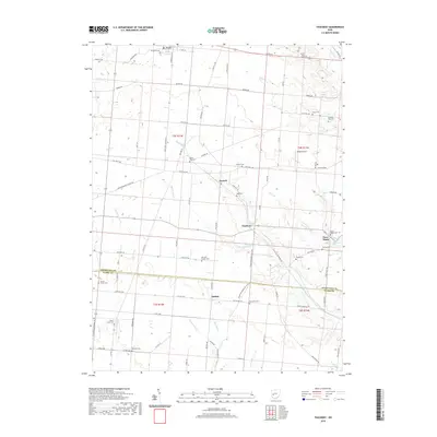
2019 Map of Thackery
USGS Topo · Published 2019About this map
St. Paris anchors the northern boundary of this western Ohio landscape, where the transition between Champaign and Clark counties is defined by a dense network of headwater streams and family-named cemeteries. Small rural centers like Thackery, Terre Haute, and Dialton are linked by a grid of early thoroughfares such as Old Troy Pike and Cow Path Rd. This 2019 survey documents a landscape where agricultural drainage and natural hydrology coexist, visible in the winding course of Donnels Cr and the engineered Thackery Ditch. Local history is deeply etched into the land through numerous burial sites, including Newsom Chapel Cem, Jenking Kite Cem, and Beech Grove Cem. The presence of Reeds Airport and the corridor of US Rte 36 reflect the continued importance of transportation in this primarily rural township setting.
Find a feature on this map
89 named features on this map. Tap any name to fly to it.
Don’t see what you’re looking for? This feature index may not catch every label — zoom into the map to look around manually.
Map Details
Editions of this 2019 Thackery Map
This is the sole edition of this map. No revisions or reprints were ever made.
Other maps of this area

1904 · Springfield
USGS Topo · 1:62,500

1904 · Dayton
USGS Topo · 1:62,500

1906 · Dayton
USGS Topo · 1:62,500

1906 · Springfield
USGS Topo · 1:62,500

1914 · Troy
USGS Topo · 1:62,500

1914 · St. Paris
USGS Topo · 1:62,500

1916 · St. Paris
USGS Topo · 1:62,500

1944 · St. Paris
USGS Topo · 1:62,500

1944 · Troy
USGS Topo · 1:62,500

1947 · Columbus
USGS Topo · 1:250,000