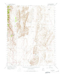
1960 Map of The Barn
USGS Topo · Published 1975About this map
The Barn Range and the House Range dominate this desert landscape in western Millard County, separated by the expansive Tule Valley. The map centers on the distinct peak known as The Barn and the small settlement at Ibex, which sits at the southern end of the range. The terrain is defined by a series of parallel north-south mountain ranges and high-altitude desert basins, featuring notable landmarks like Fossil Mtn and Steamboat Mtn.
Find a feature on this map
42 named features on this map. Tap any name to fly to it.
Don’t see what you’re looking for? This feature index may not catch every label — zoom into the map to look around manually.
Map Details
Editions of this 1960 The Barn Map
3 editions found

Other maps of this area

1908 · Fish Springs
USGS Topo · 1:250,000

1910 · Fish Springs
USGS Topo · 1:250,000

1953 · Richfield
USGS Topo · 1:250,000

1953 · Delta
USGS Topo · 1:250,000

1958 · Richfield
USGS Topo · 1:250,000

1958 · Delta
USGS Topo · 1:250,000

1960 · Notch Peak
USGS Topo · 1:62,500

1960 · Frisco Peak
USGS Topo · 1:62,500

1960 · Wah Wah Summit
USGS Topo · 1:62,500

1960 · Beaver Lake Mts.
USGS Topo · 1:62,500