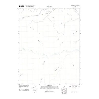
2010 Map of The Barracks
USGS Topo · Published 2010About this map
The East Fork Virgin River carves through the dramatic geology of Kane County, defining a landscape of deep canyons and prominent plateaus. High above the river valley, the White Cliffs provide a striking visual boundary across the terrain. Human presence is concentrated near the northern edge of the map, where the L D Ranch Airport is situated along the N Fork County Hwy, serving as a remote point of access.
Find a feature on this map
19 named features on this map. Tap any name to fly to it.
Don’t see what you’re looking for? This feature index may not catch every label — zoom into the map to look around manually.
Map Details
Editions of this 2010 The Barracks Map
This is the sole edition of this map. No revisions or reprints were ever made.
Other maps of this area

1886 · Kanab
USGS Topo · 1:250,000

1953 · Cedar City
USGS Topo · 1:250,000

1954 · Kanab SW
USGS Topo · 1:24,000

1954 · Orderville Canyon SE
USGS Topo · 1:24,000
1956 · Springdale SE
USGS Topo · 1:24,000
1956 · Springdale SW
USGS Topo · 1:24,000

1956 · Springdale NE
USGS Topo · 1:24,000

1957 · Kanab
USGS Topo · 1:62,500

1958 · Cedar City
USGS Topo · 1:250,000

1958 · Orderville
USGS Topo · 1:62,500