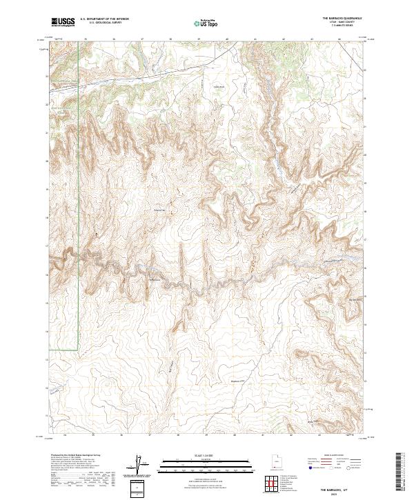
2023 Map of The Barracks
USGS Topo · Published 2023About this map
The East Fork Virgin River carves a deep, sinuous path through this section of Kane County, defining a landscape of narrow canyons and high plateaus. Within this drainage lies the distinctive corridor known as The Barracks, where the river is designated as a Virgin Wild and Scenic River. The elevation rises sharply toward the White Cliffs in the south, while the northern reaches include a portion of Zion National Park accessed by the Zion-Mount Carmel Highway. This modern survey illustrates the complex drainage systems of Mineral Gulch and Parunuweap Canyon, showing how water has sculpted the geological features of the Colorado Plateau. Names like Poverty Flat and Elephant Cove speak to the local history of ranching and exploration in this arid, high-desert environment.
Find a feature on this map
20 named features on this map. Tap any name to fly to it.
Don’t see what you’re looking for? This feature index may not catch every label — zoom into the map to look around manually.
Map Details
Editions of this 2023 The Barracks Map
This is the sole edition of this map. No revisions or reprints were ever made.
Other maps of this area

1886 · Kanab
USGS Topo · 1:250,000

1953 · Cedar City
USGS Topo · 1:250,000

1954 · Kanab SW
USGS Topo · 1:24,000

1954 · Orderville Canyon SE
USGS Topo · 1:24,000
1956 · Springdale SE
USGS Topo · 1:24,000
1956 · Springdale SW
USGS Topo · 1:24,000

1956 · Springdale NE
USGS Topo · 1:24,000

1957 · Kanab
USGS Topo · 1:62,500

1958 · Cedar City
USGS Topo · 1:250,000

1958 · Orderville
USGS Topo · 1:62,500