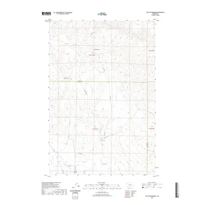
2020 Map of The Cottonwoods
USGS Topo · Published 2020About this map
Umtanum Ridge dominates the northern reaches of this central Washington landscape, where the border between Kittitas and Yakima counties cuts across high, dry terrain. The small settlement of The Cottonwoods sits at the junction of Roza Creek Rd and Old Durr Rd, representing a sparse residential footprint in an area otherwise defined by water management and transit. The Longmire Wenas Canal follows the lower elevations near Wenas Cr, illustrating the importance of irrigation in this region. Private infrastructure like the Shangri-La Airport and utility-linked corridors such as Bell Telephone Rd weave through the hills, while isolated water sources including Oasis Spring and Wright Spring provide critical points of interest in the draws of Kelley Hollow.
Find a feature on this map
28 named features on this map. Tap any name to fly to it.
Don’t see what you’re looking for? This feature index may not catch every label — zoom into the map to look around manually.
Map Details
Editions of this 2020 The Cottonwoods Map
This is the sole edition of this map. No revisions or reprints were ever made.
Other maps of this area

1899 · Ellensburg
USGS Topo · 1:125,000

1901 · Ellensburg
USGS Topo · 1:125,000

1936 · Yakima East
USGS Topo · 1:48,000

1938 · Badger Pocket
USGS Topo · 1:48,000

1941 · Yakima East
USGS Topo · 1:62,500

1943 · Badger Pocket
USGS Topo · 1:62,500

1950 · Yakima
USGS Topo · 1:250,000

1953 · Pomona
USGS Topo · 1:24,000

1953 · Kittitas
USGS Topo · 1:24,000
1953 · Wymer
USGS Topo · 1:24,000