
1934 Map of The Dalles
USGS Topo · Published 1934About this map
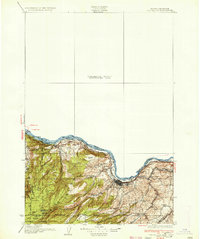
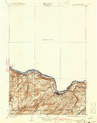
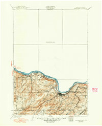
The Dalles serves as the focal point of this 1930s survey, showing a landscape defined by the heavy infrastructure and complex river geography of the Columbia River Gorge. The river corridor is marked by intense engineering, including The Dalles Canal, Fivemile Rapids, and Big Eddy, revealing the navigational challenges of the era. To the west, the Union Pacific line snakes along the shore through Mosier, while higher elevations near the Mt Hood National Forest boundary feature family-named homesteads such as Clancy Ranch and Ketchum Ranch.
Find a feature on this map
48 named features on this map. Tap any name to fly to it.
Don’t see what you’re looking for? This feature index may not catch every label — zoom into the map to look around manually.
Map Details
Editions of this 1934 The Dalles Map
4 editions found
Other maps of this area

1904 · Mount Adams
USGS Topo · 1:125,000

1907 · Mount Adams
USGS Topo · 1:125,000

1924 · Mount Hood
USGS Topo · 1:125,000

1926 · Steamboat Mtn
USGS Topo · 1:125,000

1926 · Hood River
USGS Topo · 1:125,000

1927 · Mount Hood
USGS Topo · 1:125,000

1929 · Hood River
USGS Topo · 1:125,000

1930 · Dufur
USGS Topo · 1:125,000

1931 · Steamboat Mtn
USGS Topo · 1:125,000

1934 · Dufur
USGS Topo · 1:125,000