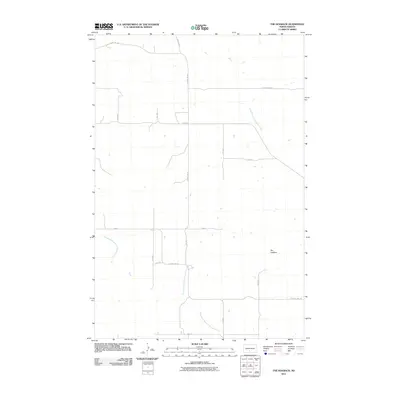
2011 Map of The Hogback
USGS Topo · Published 2011About this map
The ridge of The Hogback rises as a prominent landmark amidst the section-line roads and seasonal drainage networks of Morton County. In this early twenty-first-century survey, the landscape is defined by the headwaters of several key watercourses, including the North Branch Cantapeta Creek and the Northwest Branch Cantapeta Creek, which draw their paths across the prairie. The western portion of the quadrangle is shaped by the Southeast Branch Little Heart River, illustrating the subtle yet critical hydrology that dictates land use in this part of North Dakota.
Find a feature on this map
18 named features on this map. Tap any name to fly to it.
Don’t see what you’re looking for? This feature index may not catch every label — zoom into the map to look around manually.
Map Details
Editions of this 2011 The Hogback Map
This is the sole edition of this map. No revisions or reprints were ever made.
Other maps of this area

1907 · Bismarck
USGS Topo · 1:125,000

1954 · Bismarck
USGS Topo · 1:250,000

1958 · Bismarck
USGS Topo · 1:250,000

1962 · Sugarloaf Butte
USGS Topo · 1:24,000

1962 · Schmidt
USGS Topo · 1:24,000

1968 · Cannon Ball NW
USGS Topo · 1:24,000

1971 · Huff
USGS Topo · 1:24,000
1976 · Sugarloaf Butte
USGS Topo · 1:24,000

1979 · Bismarck
USGS Topo · 1:100,000

1980 · Solen
USGS Topo · 1:24,000