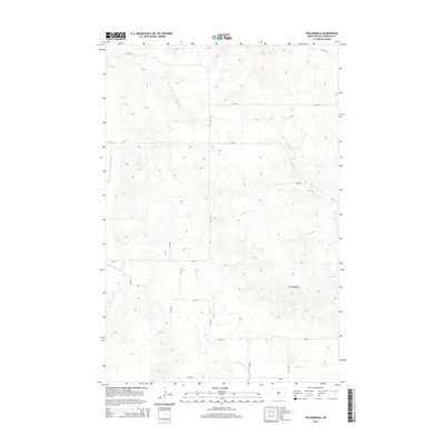
2014 Map of The Hogback
USGS Topo · Published 2014About this map
The Hogback rises as a prominent topographical landmark in this rural section of Morton County, anchoring a landscape defined by the drainage networks of the Missouri River watershed. The terrain is intricately carved by the Northwest Br Cantapeta Cr and the N Br Cantapeta Cr, which flow through the eastern and central portions of the quadrangle. To the west, the headwaters of the Southeast Br Little Heart River shape the contours of the land.
Find a feature on this map
19 named features on this map. Tap any name to fly to it.
Don’t see what you’re looking for? This feature index may not catch every label — zoom into the map to look around manually.
Map Details
Editions of this 2014 The Hogback Map
This is the sole edition of this map. No revisions or reprints were ever made.
Other maps of this area

1907 · Bismarck
USGS Topo · 1:125,000

1954 · Bismarck
USGS Topo · 1:250,000

1958 · Bismarck
USGS Topo · 1:250,000

1962 · Sugarloaf Butte
USGS Topo · 1:24,000

1962 · Schmidt
USGS Topo · 1:24,000

1968 · Cannon Ball NW
USGS Topo · 1:24,000

1971 · Huff
USGS Topo · 1:24,000
1976 · Sugarloaf Butte
USGS Topo · 1:24,000

1979 · Bismarck
USGS Topo · 1:100,000

1980 · Solen
USGS Topo · 1:24,000