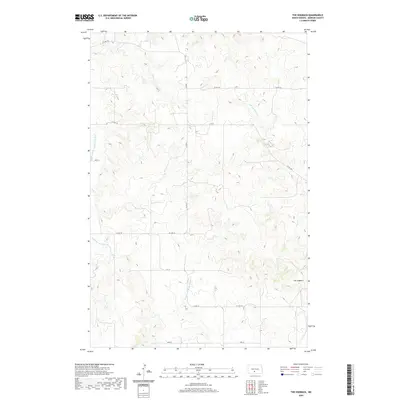
2020 Map of The Hogback
USGS Topo · Published 2020About this map
The Hogback rises as a prominent landform above the rolling plains of Morton County, North Dakota, anchoring the eastern edge of this survey. This high ground overlooks a landscape defined by the drainage systems of the Southeast Br Little Heart River to the west and the various forks of N Br Cantapeta Cr and Northwest Br Cantapeta Cr to the east. The map reveals a highly structured rural environment organized by a precise grid of sections and section-line roads, including Co Rd 81 and Co Rd 135. This network suggests a landscape dedicated to large-scale agriculture and ranching, where the natural contours of the hills are the primary interruption to an otherwise orderly human arrangement of the territory.
Find a feature on this map
17 named features on this map. Tap any name to fly to it.
Don’t see what you’re looking for? This feature index may not catch every label — zoom into the map to look around manually.
Map Details
Editions of this 2020 The Hogback Map
This is the sole edition of this map. No revisions or reprints were ever made.
Other maps of this area

1907 · Bismarck
USGS Topo · 1:125,000

1954 · Bismarck
USGS Topo · 1:250,000

1958 · Bismarck
USGS Topo · 1:250,000

1962 · Sugarloaf Butte
USGS Topo · 1:24,000

1962 · Schmidt
USGS Topo · 1:24,000

1968 · Cannon Ball NW
USGS Topo · 1:24,000

1971 · Huff
USGS Topo · 1:24,000
1976 · Sugarloaf Butte
USGS Topo · 1:24,000

1979 · Bismarck
USGS Topo · 1:100,000

1980 · Solen
USGS Topo · 1:24,000