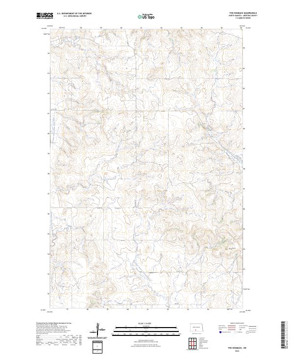
2024 Map of The Hogback
USGS Topo · Published 2024About this map
The Hogback rises as a prominent landmark in this section of rural Morton County, anchoring a landscape defined by the branching headwaters of regional drainage systems. The terrain is deeply etched by the Southeast Branch Little Heart River, which meanders through the western portion of the quadrangle, while the east and south are shaped by the North Branch Cantapeta Creek and Northwest Branch Cantapeta Creek. This 2024 survey illustrates the persistent section-line road grid that governs movement across the North Dakota plains, featuring routes like Co RD 81 and Co RD 136. The map captures the specialized agricultural character of the region, where wide-open spaces are segmented by township boundaries such as t136n r81w and t135n r80w, reflecting the enduring structure of the Public Land Survey System in the modern era.
Find a feature on this map
16 named features on this map. Tap any name to fly to it.
Don’t see what you’re looking for? This feature index may not catch every label — zoom into the map to look around manually.
Map Details
Editions of this 2024 The Hogback Map
This is the sole edition of this map. No revisions or reprints were ever made.
Other maps of this area

1907 · Bismarck
USGS Topo · 1:125,000

1954 · Bismarck
USGS Topo · 1:250,000

1958 · Bismarck
USGS Topo · 1:250,000

1962 · Sugarloaf Butte
USGS Topo · 1:24,000

1962 · Schmidt
USGS Topo · 1:24,000

1968 · Cannon Ball NW
USGS Topo · 1:24,000

1971 · Huff
USGS Topo · 1:24,000
1976 · Sugarloaf Butte
USGS Topo · 1:24,000

1979 · Bismarck
USGS Topo · 1:100,000

1980 · Solen
USGS Topo · 1:24,000