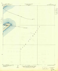
1933 Map of The Jetties
USGS Topo · Published 1949About this map
North Jetty and South Jetty define this maritime landscape at the entrance to Galveston Bay, extending miles into the Gulf of Mexico. Compiled from aerial photography taken by the Army Air Corps in the early 1930s, the map documents the critical navigation aids that guarded the pass, including the North Jetty L H and the Galveston Jetty L H. The geography is dominated by the narrow tip of the Bolivar Peninsula to the north and the expansive East Beach on Galveston Island to the south. A single land route, South Jetty Road, provides access to the southern breakwater. This survey captures the coastline before extensive modern development, showing the transition from sandy barrier island terrain to the engineered stone structures essential for Texas gulf commerce.
Find a feature on this map
12 named features on this map. Tap any name to fly to it.
Don’t see what you’re looking for? This feature index may not catch every label — zoom into the map to look around manually.
Map Details
Editions of this 1933 The Jetties Map
2 editions found
Other maps of this area

1930 · Galveston
USGS Topo · 1:24,000

1931 · Flake
USGS Topo · 1:24,000

1932 · Bolivar Point
USGS Topo · 1:24,000

1933 · Caplen
USGS Topo · 1:31,680

1933 · The Jetties
USGS Topo · 1:31,680

1933 · Bolivar Point
USGS Topo · 1:31,680

1933 · Flake
USGS Topo · 1:31,680
1933 · Galveston
USGS Topo · 1:31,680
1943 · Flake
USGS Topo · 1:25,000
1943 · Port Bolivar
USGS Topo · 1:24,000