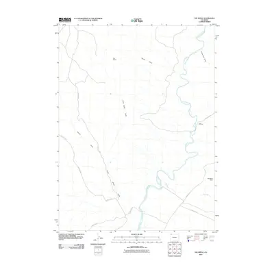
2010 Map of The Nipple
USGS Topo · Published 2010About this map
The Little Snake River carves a winding path through this corner of Moffat County, defining a landscape of deep drainages and prominent high points. A solitary center of activity is noted at Nipple Rim Ranch, situated near the river as it makes a sharp southern bend. The area is characterized by its complex system of canyons and washes, including Nipple Gulch and South Nipple Gulch, which feed toward the main river channel from the northwest.
Find a feature on this map
15 named features on this map. Tap any name to fly to it.
Don’t see what you’re looking for? This feature index may not catch every label — zoom into the map to look around manually.
Map Details
Editions of this 2010 The Nipple Map
This is the sole edition of this map. No revisions or reprints were ever made.
Other maps of this area

1954 · Vernal
USGS Topo · 1:250,000

1958 · Vernal
USGS Topo · 1:250,000

1958 · Maybell
USGS Topo · 1:62,500

1960 · Vernal
USGS Topo · 1:250,000

1960 · Lone Mountain
USGS Topo · 1:62,500

1969 · Reservoir Draw
USGS Topo · 1:24,000
1969 · The Nipple SE
USGS Topo · 1:24,000

1969 · The Nipple
USGS Topo · 1:24,000
1969 · The Nipple NE
USGS Topo · 1:24,000

1969 · Powder Wash
USGS Topo · 1:24,000