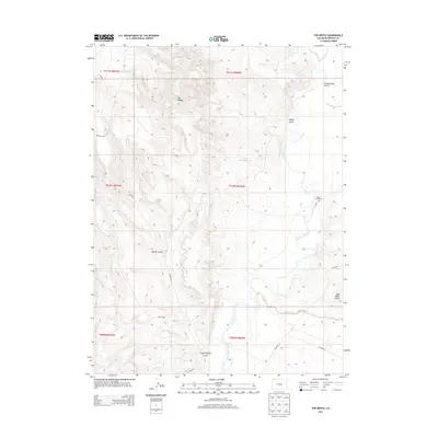
2013 Map of The Nipple
USGS Topo · Published 2013About this map
The Little Snake River carves a winding path through this corner of Moffat County, defining a landscape of high desert drainage and dramatic topography. This 2013 survey highlights the namesake peak of The Nipple, which serves as a central landmark for the surrounding network of dry gulches, including Greasewood Gulch and Spence Gulch. The presence of Nipple Rim Ranch in the eastern section indicates the area's continued use for livestock, while infrastructure like Nate Spring Reservoir points to the necessity of water management in this arid environment.
Find a feature on this map
22 named features on this map. Tap any name to fly to it.
Don’t see what you’re looking for? This feature index may not catch every label — zoom into the map to look around manually.
Map Details
Editions of this 2013 The Nipple Map
This is the sole edition of this map. No revisions or reprints were ever made.
Other maps of this area

1954 · Vernal
USGS Topo · 1:250,000

1958 · Vernal
USGS Topo · 1:250,000

1958 · Maybell
USGS Topo · 1:62,500

1960 · Vernal
USGS Topo · 1:250,000

1960 · Lone Mountain
USGS Topo · 1:62,500

1969 · Reservoir Draw
USGS Topo · 1:24,000
1969 · The Nipple SE
USGS Topo · 1:24,000

1969 · The Nipple
USGS Topo · 1:24,000
1969 · The Nipple NE
USGS Topo · 1:24,000

1969 · Powder Wash
USGS Topo · 1:24,000