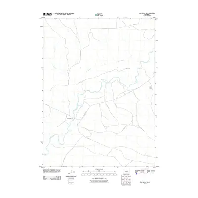
2010 Map of The Nipple NE
USGS Topo · Published 2010About this map
The Little Snake River meanders across this corner of Moffat County, defining the drainage patterns and transportation corridors of the High Desert. At the start of the 21st century, the landscape remained characterized by its industrial and ranching infrastructure, evidenced by the Little Snake One Mine and a complex network of arterial roads. The crossing at Edinger Bridge provides a vital link across the river, connecting County Rd-149 with the broader valley. Local landmarks such as Powder Wash reveal the intermittent watercourses that shape this arid terrain, while the extensive grid of routes including County Hwy-4 and County Hwy-7 highlights the region's role as a transit point for energy resources and livestock.
Find a feature on this map
15 named features on this map. Tap any name to fly to it.
Don’t see what you’re looking for? This feature index may not catch every label — zoom into the map to look around manually.
Map Details
Editions of this 2010 The Nipple NE Map
This is the sole edition of this map. No revisions or reprints were ever made.
Other maps of this area

1916 · Craig
USGS Topo · 1:125,000

1954 · Vernal
USGS Topo · 1:250,000

1954 · Rawlins
USGS Topo · 1:250,000

1954 · Rock Springs
USGS Topo · 1:250,000

1954 · Craig
USGS Topo · 1:250,000

1957 · Craig
USGS Topo · 1:250,000

1958 · Rawlins
USGS Topo · 1:250,000

1958 · Vernal
USGS Topo · 1:250,000

1958 · Rock Springs
USGS Topo · 1:250,000

1958 · Craig
USGS Topo · 1:250,000