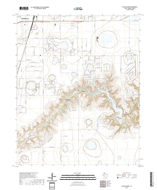
2022 Map of The Palisades
USGS Topo · Published 2022About this map
Palo Duro Canyon and the Timbercreek Canyon define the landscape south of Amarillo, where the High Plains drop sharply into the breaks of the Prairie Dog Town Fork Red River. This 2022 survey documents the residential development of The Palisades and the gated community around Lake Tanglewood, illustrating how modern settlement has integrated into the natural erosion features of the Llano Estacado. The map captures a transitional zone between the urban expansion represented by Zita and the dramatic topography of the Devils Kitchen. Aviation infrastructure is prominent with the inclusion of Blue Sky Airfield and River Falls Airport, while the intricate network of residential roads like Claude Hwy and W Hollywood Rd reflects the area's growth as a suburban and recreational extension of the nearby city.
Find a feature on this map
114 named features on this map. Tap any name to fly to it.
Don’t see what you’re looking for? This feature index may not catch every label — zoom into the map to look around manually.
Map Details
Editions of this 2022 The Palisades Map
This is the sole edition of this map. No revisions or reprints were ever made.
Other maps of this area

1954 · Amarillo
USGS Topo · 1:250,000

1954 · Plainview
USGS Topo · 1:250,000

1956 · Fortress Cliff
USGS Topo · 1:24,000

1956 · Amarillo East
USGS Topo · 1:24,000

1956 · Thomas Ranch
USGS Topo · 1:24,000

1956 · Pullman
USGS Topo · 1:24,000

1958 · Amarillo
USGS Topo · 1:250,000

1958 · Plainview
USGS Topo · 1:250,000

1960 · Canyon
USGS Topo · 1:62,500

1960 · The Palisades
USGS Topo · 1:24,000