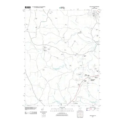
2010 Map of The Plains
USGS Topo · Published 2010About this map
The Plains and its surrounding rural communities are captured in this 2010 USGS snapshot of the landscape west of Athens. The settlement patterns follow the winding path of Margaret Creek and its many tributaries, with small clusters of homes at New Marshfield and Hebardville anchoring the western and southern reaches. Local family histories are etched into the terrain through dozens of small burying grounds, from Young Cemetery on the northern hills to Minear Cemetery in the southwest, suggesting a long history of family homesteads across this region of the Hocking River valley.
Find a feature on this map
92 named features on this map. Tap any name to fly to it.
Don’t see what you’re looking for? This feature index may not catch every label — zoom into the map to look around manually.
Map Details
Editions of this 2010 The Plains Map
This is the sole edition of this map. No revisions or reprints were ever made.
Other maps of this area

1903 · Athens
USGS Topo · 1:62,500

1904 · Zaleski
USGS Topo · 1:62,500

1905 · Athens
USGS Topo · 1:62,500

1905 · Wilkesville
USGS Topo · 1:62,500

1907 · Pomeroy
USGS Topo · 1:62,500

1907 · Zaleski
USGS Topo · 1:62,500

1908 · Wilkesville
USGS Topo · 1:62,500

1947 · Columbus
USGS Topo · 1:250,000

1960 · Albany
USGS Topo · 1:24,000
1960 · Shade
USGS Topo · 1:24,000