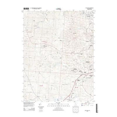
2013 Map of The Plains
USGS Topo · Published 2013About this map
The Plains stands as a primary population center in this 2013 topographic survey of the Athens, Ohio area, situated near the winding Hocking River. The landscape is a network of ridges and hollows, such as Gowler Ridge and Ross Hollow, punctuated by several smaller communities including New Marshfield, Luhrig, and Brookville. Genealogists and local historians will find a high density of rural burial sites, from the larger Zion Cem to family-named plots like Carter Cem, Stover Cem, and Ross Cem.
Find a feature on this map
110 named features on this map. Tap any name to fly to it.
Don’t see what you’re looking for? This feature index may not catch every label — zoom into the map to look around manually.
Map Details
Editions of this 2013 The Plains Map
This is the sole edition of this map. No revisions or reprints were ever made.
Other maps of this area

1903 · Athens
USGS Topo · 1:62,500

1904 · Zaleski
USGS Topo · 1:62,500

1905 · Athens
USGS Topo · 1:62,500

1905 · Wilkesville
USGS Topo · 1:62,500

1907 · Pomeroy
USGS Topo · 1:62,500

1907 · Zaleski
USGS Topo · 1:62,500

1908 · Wilkesville
USGS Topo · 1:62,500

1947 · Columbus
USGS Topo · 1:250,000

1960 · Albany
USGS Topo · 1:24,000
1960 · Shade
USGS Topo · 1:24,000