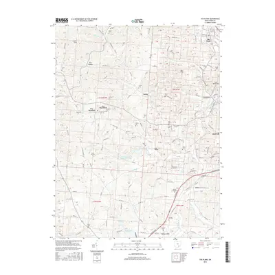
2016 Map of The Plains
USGS Topo · Published 2016About this map
The Plains serves as a primary residential center in this part of Athens County, situated north of the expansive drainage systems of Margaret Creek. The landscape is defined by its deep-set valleys and numerous ridges such as Gowler Ridge and Vore Ridge, which separate the various branches of the creek system. This 2016 survey shows the prominent water management structures of the area, specifically the Margaret Cr Conservancy District Reservoir and the nearby Lake Snowden to the south.
Find a feature on this map
150 named features on this map. Tap any name to fly to it.
Don’t see what you’re looking for? This feature index may not catch every label — zoom into the map to look around manually.
Map Details
Editions of this 2016 The Plains Map
This is the sole edition of this map. No revisions or reprints were ever made.
Other maps of this area

1903 · Athens
USGS Topo · 1:62,500

1904 · Zaleski
USGS Topo · 1:62,500

1905 · Athens
USGS Topo · 1:62,500

1905 · Wilkesville
USGS Topo · 1:62,500

1907 · Pomeroy
USGS Topo · 1:62,500

1907 · Zaleski
USGS Topo · 1:62,500

1908 · Wilkesville
USGS Topo · 1:62,500

1947 · Columbus
USGS Topo · 1:250,000

1960 · Albany
USGS Topo · 1:24,000
1960 · Shade
USGS Topo · 1:24,000