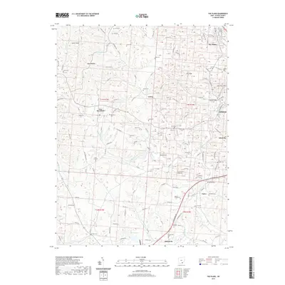
2019 Map of The Plains
USGS Topo · Published 2019About this map
The Plains and the surrounding Athens County landscape appear in this contemporary 2019 survey, illustrating the complex drainage of Margaret Creek and its various branches. The area is defined by a dense network of country roads and small settlements like Luhrig, New Marshfield, and Grosvenor. A striking number of small family and community burial grounds are mapped across these hills, including Stover Cem, Hewitt Cem, and Pierce Cem, offering a valuable record for genealogical research in this part of Ohio.
Find a feature on this map
254 named features on this map. Tap any name to fly to it.
Don’t see what you’re looking for? This feature index may not catch every label — zoom into the map to look around manually.
Map Details
Editions of this 2019 The Plains Map
This is the sole edition of this map. No revisions or reprints were ever made.
Other maps of this area

1903 · Athens
USGS Topo · 1:62,500

1904 · Zaleski
USGS Topo · 1:62,500

1905 · Athens
USGS Topo · 1:62,500

1905 · Wilkesville
USGS Topo · 1:62,500

1907 · Pomeroy
USGS Topo · 1:62,500

1907 · Zaleski
USGS Topo · 1:62,500

1908 · Wilkesville
USGS Topo · 1:62,500

1947 · Columbus
USGS Topo · 1:250,000

1960 · Albany
USGS Topo · 1:24,000
1960 · Shade
USGS Topo · 1:24,000