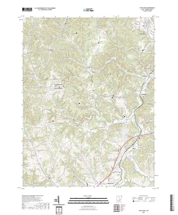
2023 Map of The Plains
USGS Topo · Published 2023About this map
The Plains and the rolling hills of the Athens County countryside are defined by a complex drainage system feeding into Margaret Creek and its various branches. This 2023 survey provides a contemporary perspective on long-established communities like New Marshfield and Luhrig, illustrating how modern residential patterns have integrated with the historical geography of Southeast Ohio. The landscape is dotted with numerous ancestral burial grounds, ranging from the Marshfield Cem near the western edge to the Snowden Cem further south. The southern portion of the quadrangle is anchored by the recreational and ecological landmark of Lake Snowden, while the eastern margin transitions into the outskirts of Athens and Elliottville. Distinctive landforms such as Vore Ridge and Stage Mound Hill break the horizon, separating the headwaters of Factory Creek from the Ross Hollow valley.
Find a feature on this map
228 named features on this map. Tap any name to fly to it.
Don’t see what you’re looking for? This feature index may not catch every label — zoom into the map to look around manually.
Map Details
Editions of this 2023 The Plains Map
This is the sole edition of this map. No revisions or reprints were ever made.
Other maps of this area

1903 · Athens
USGS Topo · 1:62,500

1904 · Zaleski
USGS Topo · 1:62,500

1905 · Athens
USGS Topo · 1:62,500

1905 · Wilkesville
USGS Topo · 1:62,500

1907 · Pomeroy
USGS Topo · 1:62,500

1907 · Zaleski
USGS Topo · 1:62,500

1908 · Wilkesville
USGS Topo · 1:62,500

1947 · Columbus
USGS Topo · 1:250,000

1960 · Albany
USGS Topo · 1:24,000
1960 · Shade
USGS Topo · 1:24,000