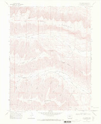
1968 Map of The Saddle
USGS Topo · Published 1972About this map
Kimball Mountain and Horse Mountain dominate this corner of Garfield County, separated by a complex network of gulches and ridges. The 1968 aerial survey work records a landscape defined by significant water management features, notably the Caughman Ditch and Cottonwood Ditch, which suggest the agricultural demands of the high plateau. Between these peaks lies The Saddle, a prominent natural pass connecting Cow Ridge to the surrounding terrain. Small-scale resource extraction or exploration is evidenced by a Drill Hole located near the head of Stewart Gulch. Numerous family-named or local landmarks, such as McMullen Spring and Pedigo Gulch, provide essential reference points for genealogists and local historians tracing land use in this western Colorado drainage basin above Roan Creek.
Find a feature on this map
26 named features on this map. Tap any name to fly to it.
Don’t see what you’re looking for? This feature index may not catch every label — zoom into the map to look around manually.
Map Details
Editions of this 1968 The Saddle Map
This is the sole edition of this map. No revisions or reprints were ever made.
Other maps of this area

1929 · Highmore
USGS Topo · 1:62,500

1929 · Roan Creek
USGS Topo · 1:62,500

1956 · Grand Junction
USGS Topo · 1:250,000

1959 · Grand Junction
USGS Topo · 1:250,000

1960 · Grand Junction
USGS Topo · 1:250,000

1962 · Grand Junction
USGS Topo · 1:250,000

1964 · Grand Junction
USGS Topo · 1:250,000

1964 · Henderson Ridge
USGS Topo · 1:24,000

1965 · Grand Junction
USGS Topo · 1:250,000
1968 · Middle Dry Fork
USGS Topo · 1:24,000