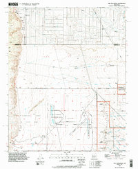
1990 Map of The Volcanoes
USGS Topo · Published 1996About this map
The Volcanoes rise prominently from the West Mesa, defining a geological and cultural landscape preserved within the Petroglyph National Monument. This 1990s record details a string of volcanic vents including Vulcan Volcano, Black Volcano, and J A Volcano, set against the historical lines of the Town of Alameda Grant Boundary and the Town of Atrisco Grant Boundary.
Find a feature on this map
32 named features on this map. Tap any name to fly to it.
Don’t see what you’re looking for? This feature index may not catch every label — zoom into the map to look around manually.
Map Details
Editions of this 1990 The Volcanoes Map
This is the sole edition of this map. No revisions or reprints were ever made.
Other maps of this area

1888 · Bernalillo
USGS Topo · 1:125,000

1889 · Albuquerque
USGS Topo · 1:125,000

1893 · Albuquerque
USGS Topo · 1:125,000

1934 · West Albuquerque
USGS Topo · 1:24,000

1934 · Griegos
USGS Topo · 1:24,000

1938 · Albuquerque
USGS Topo · 1:62,500

1954 · Volcano Ranch
USGS Topo · 1:24,000

1954 · Loma Machete
USGS Topo · 1:24,000

1954 · Sky Village
USGS Topo · 1:24,000
1954 · Sky Village SE
USGS Topo · 1:24,000