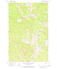
1967 Map of The Wigwams
USGS Topo · Published 1978About this map
Kaniksu National Forest dominates this 1967 survey of northern Idaho, where the high-elevation terrain of the Selkirk Mountains defines the landscape. The map centers on the namesake The Wigwams, a distinctive formation flanked by prominent summits like Kent Peak and Harrison Peak. This area is characterized by a high concentration of glacial cirque lakes, including Harrison Lake, the Beehive Lakes, and Two Mouth Lakes, which feed into the complex drainage systems of Lion Creek and Myrtle Creek. Evidence of fire management and wilderness observation is visible at Squawman Lookout, while the presence of a State Game Preserve indicates the region's historical importance for wildlife conservation. The lack of improved roads and the reliance on a sparse network of jeep trails highlights the remote, primitive nature of this forest boundary region during the mid-20th century.
Find a feature on this map
33 named features on this map. Tap any name to fly to it.
Don’t see what you’re looking for? This feature index may not catch every label — zoom into the map to look around manually.
Map Details
Editions of this 1967 The Wigwams Map
Other maps of this area

1911 · Priest Lake
USGS Topo · 1:250,000

1913 · Priest Lake
USGS Topo · 1:250,000

1958 · Sandpoint
USGS Topo · 1:250,000

1963 · Sandpoint
USGS Topo · 1:250,000

1967 · Priest Lake SE
USGS Topo · 1:24,000

1967 · Priest Lake NE
USGS Topo · 1:24,000

1967 · The Wigwams
USGS Topo · 1:24,000
1967 · Roman Nose
USGS Topo · 1:24,000

1967 · Mount Roothaan
USGS Topo · 1:24,000
1967 · Dodge Peak
USGS Topo · 1:24,000