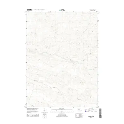
2014 Map of Thedford SW
USGS Topo · Published 2014About this map
The Dismal River carves a distinct path through the Nebraska Sandhills, serving as the primary geographical anchor for this portion of Thomas County. This 2014 survey documents a landscape dominated by topographic relief and organized around isolated ranching infrastructure. The presence of Paxton Ranch Rd indicates the enduring importance of large-scale landholdings in this region, where connectivity is maintained through localized routes like Leroy Ln and Connell Ln. Running north-south along the eastern edge of the river corridor, River Ave provides one of the few established north-south transit points through the dunes. The map's detailed contour lines illustrate the complex dune formations that characterize this part of the state, revealing how local roads are forced to navigate the natural undulations of the terrain near the river valley.
Find a feature on this map
5 named features on this map. Tap any name to fly to it.
Don’t see what you’re looking for? This feature index may not catch every label — zoom into the map to look around manually.
Map Details
Editions of this 2014 Thedford SW Map
This is the sole edition of this map. No revisions or reprints were ever made.
Other maps of this area

1948 · Thedford
USGS Topo · 1:62,500

1949 · Cody Lake
USGS Topo · 1:62,500

1950 · Thedford
USGS Topo · 1:62,500

1950 · Shimmins Lake
USGS Topo · 1:62,500

1951 · Tryon
USGS Topo · 1:62,500

1951 · Cody Lake
USGS Topo · 1:62,500

1954 · North Platte
USGS Topo · 1:250,000

1956 · North Platte
USGS Topo · 1:250,000

1957 · North Platte
USGS Topo · 1:250,000

1967 · North Platte
USGS Topo · 1:250,000