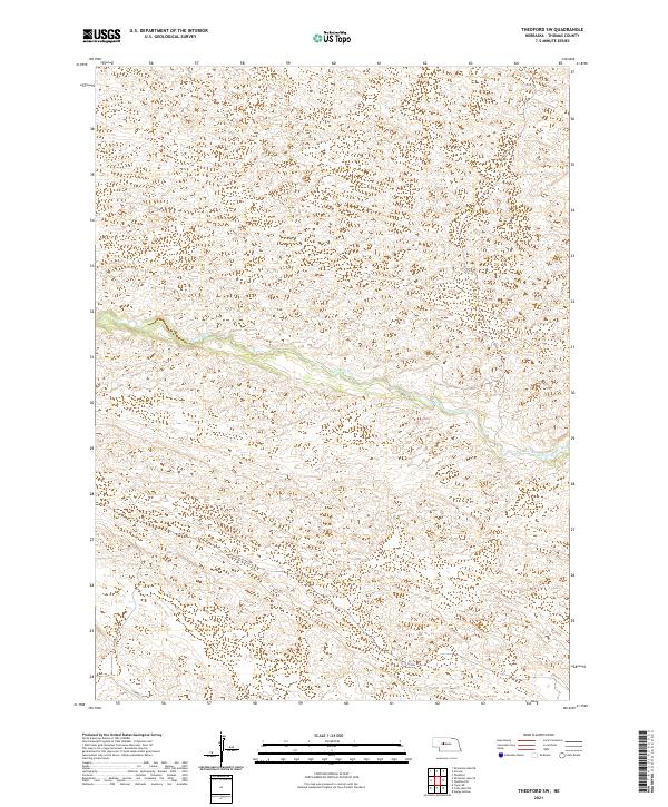
2021 Map of Thedford SW
USGS Topo · Published 2021About this map
Dismal River carves a winding path through the heart of this Thomas County landscape, which is defined by an intricate network of sand hills and depressions. The terrain suggests a rural rangeland environment where the few established routes, such as Peaceful Plains Rd and Paxton Ranch Rd, follow the natural contours of the undulating Nebraska topography. Small, seasonal water bodies dot the valleys between the ridges, illustrating the complex hydrography of the Sandhills region. Settlement is sparse, with mobility provided by local connectors like River Ave and Leroy Ln that navigate the gaps between the high dunes. This survey provides a modern record of land divisions across townships T22N R30W, T22N R29W, T21N R30W, and T21N R29W, reflecting the enduring grid of the Public Land Survey System in an otherwise fluid and shifting geomorphology.
Find a feature on this map
10 named features on this map. Tap any name to fly to it.
Don’t see what you’re looking for? This feature index may not catch every label — zoom into the map to look around manually.
Map Details
Editions of this 2021 Thedford SW Map
This is the sole edition of this map. No revisions or reprints were ever made.
Other maps of this area

1948 · Thedford
USGS Topo · 1:62,500

1949 · Cody Lake
USGS Topo · 1:62,500

1950 · Thedford
USGS Topo · 1:62,500

1950 · Shimmins Lake
USGS Topo · 1:62,500

1951 · Tryon
USGS Topo · 1:62,500

1951 · Cody Lake
USGS Topo · 1:62,500

1954 · North Platte
USGS Topo · 1:250,000

1956 · North Platte
USGS Topo · 1:250,000

1957 · North Platte
USGS Topo · 1:250,000

1967 · North Platte
USGS Topo · 1:250,000