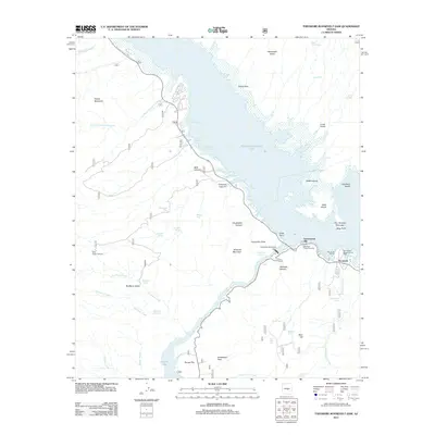
2011 Map of Theodore Roosevelt Dam
USGS Topo · Published 2011About this map
Theodore Roosevelt Dam stands as the central engineering landmark of this Gila County landscape, holding back the waters of Theodore Roosevelt Lake. The surrounding area shows the infrastructure required to manage this vital water resource, including Salt River Project Housing and the Tonto Basin Ranger District Office. Small settlements and seasonal hubs like Roosevelt and the Roosevelt Marina provide access to the lake's northern shores, while the southern reaches of the map follow the Salt River downstream toward Apache Lake.
Find a feature on this map
59 named features on this map. Tap any name to fly to it.
Don’t see what you’re looking for? This feature index may not catch every label — zoom into the map to look around manually.
Map Details
Editions of this 2011 Theodore Roosevelt Dam Map
This is the sole edition of this map. No revisions or reprints were ever made.
Other maps of this area

1907 · Roosevelt
USGS Topo · 1:125,000

1909 · Four Peaks
USGS Topo · 1:125,000

1912 · Roosevelt
USGS Topo · 1:125,000

1954 · Mesa
USGS Topo · 1:250,000

1957 · Mesa
USGS Topo · 1:250,000

1958 · Mesa
USGS Topo · 1:250,000

1960 · Mesa
USGS Topo · 1:250,000

1964 · Mesa
USGS Topo · 1:250,000
1964 · Armer Mountain
USGS Topo · 1:24,000
1964 · Greenback Creek
USGS Topo · 1:24,000