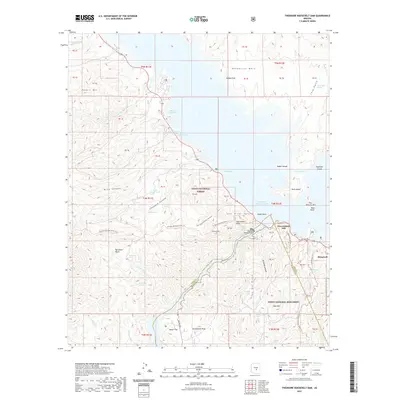
2021 Map of Theodore Roosevelt Dam
USGS Topo · Published 2021About this map
Theodore Roosevelt Dam stands as the central engineering landmark of this desert landscape, where the Salt River is impounded to form the expansive Theodore Roosevelt Lake. This modern topographic survey reveals a terrain defined by dramatic elevation changes, from the depths of Mills Canyon and Vineyard Canyon to high points like Sweetheart Peak and Peters Mtn. The settlement of Roosevelt sits near the dam's southern reaches, while the historic Apache Trl winds along the river valley.
Find a feature on this map
60 named features on this map. Tap any name to fly to it.
Don’t see what you’re looking for? This feature index may not catch every label — zoom into the map to look around manually.
Map Details
Editions of this 2021 Theodore Roosevelt Dam Map
This is the sole edition of this map. No revisions or reprints were ever made.
Other maps of this area

1907 · Roosevelt
USGS Topo · 1:125,000

1909 · Four Peaks
USGS Topo · 1:125,000

1912 · Roosevelt
USGS Topo · 1:125,000

1954 · Mesa
USGS Topo · 1:250,000

1957 · Mesa
USGS Topo · 1:250,000

1958 · Mesa
USGS Topo · 1:250,000

1960 · Mesa
USGS Topo · 1:250,000

1964 · Mesa
USGS Topo · 1:250,000
1964 · Armer Mountain
USGS Topo · 1:24,000
1964 · Greenback Creek
USGS Topo · 1:24,000