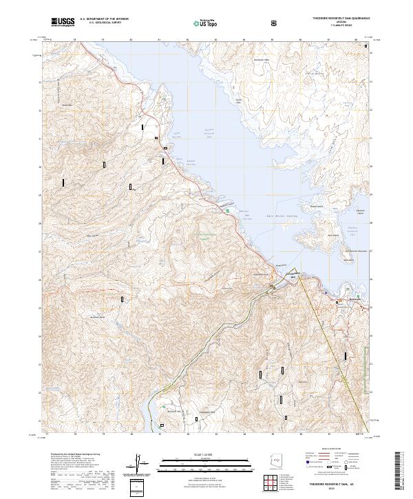
2023 Map of Theodore Roosevelt Dam
USGS Topo · Published 2023About this map
The Theodore Roosevelt Lake reservoir dominates this landscape where the Salt River meets the confluence of numerous desert washes. The settlement of Roosevelt sits near the eastern shore, providing a focal point for the region's historical developments. Nearby, the Historic Roosevelt Cem offers a direct link to the community's past residents. The map captures a complex network of rugged terrain and water management features, including several named coves like Cholla Bay Area and Bachelor Cove Area.
Find a feature on this map
75 named features on this map. Tap any name to fly to it.
Don’t see what you’re looking for? This feature index may not catch every label — zoom into the map to look around manually.
Map Details
Editions of this 2023 Theodore Roosevelt Dam Map
This is the sole edition of this map. No revisions or reprints were ever made.
Other maps of this area

1907 · Roosevelt
USGS Topo · 1:125,000

1909 · Four Peaks
USGS Topo · 1:125,000

1912 · Roosevelt
USGS Topo · 1:125,000

1954 · Mesa
USGS Topo · 1:250,000

1957 · Mesa
USGS Topo · 1:250,000

1958 · Mesa
USGS Topo · 1:250,000

1960 · Mesa
USGS Topo · 1:250,000

1964 · Mesa
USGS Topo · 1:250,000
1964 · Armer Mountain
USGS Topo · 1:24,000
1964 · Greenback Creek
USGS Topo · 1:24,000