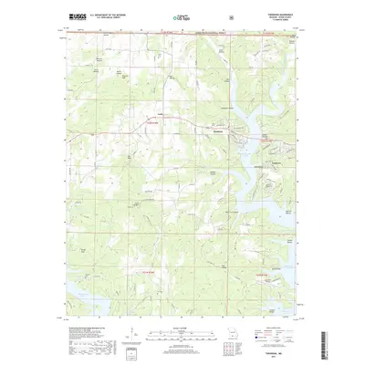
2017 Map of Theodosia
USGS Topo · Published 2017About this map
The rugged landscape of Ozark County is defined here by the winding fingers of Bull Shoals Lake, which fills the deep valleys once carved by the Little North Fork White River and its many tributaries. The town of Theodosia serves as a central hub, situated near the bridge crossing where the Pond Fork meets the main body of the lake. To the west, the village of Lutie marks a transition into the high ridges and knobs that characterize the Mark Twain National Forest. The topography is a maze of named hollows, including Willhoit Hollow and Rail Hollow, and prominent summits such as Peacock Bald and Chain Link Mtn. Local history is preserved in small upland burial sites like Hicks Cem and Hart Cem, while the modern recreational character of the area is evident in the residential developments of Sundown and the presence of the Lost Mine Airport near the lake's southern reaches.
Find a feature on this map
116 named features on this map. Tap any name to fly to it.
Don’t see what you’re looking for? This feature index may not catch every label — zoom into the map to look around manually.
Map Details
Editions of this 2017 Theodosia Map
This is the sole edition of this map. No revisions or reprints were ever made.
Other maps of this area

1893 · Yellville
USGS Topo · 1:125,000

1903 · Yellville
USGS Topo · 1:125,000

1905 · Yellville
USGS Topo · 1:125,000

1929 · Yellville
USGS Topo · 1:125,000

1936 · Thornfield
USGS Topo · 1:48,000

1943 · Protem
USGS Topo · 1:62,500

1943 · Thornfield
USGS Topo · 1:62,500

1945 · Harrison
USGS Topo · 1:250,000

1945 · Thornfield
USGS Topo · 1:62,500

1949 · Harrison
USGS Topo · 1:250,000