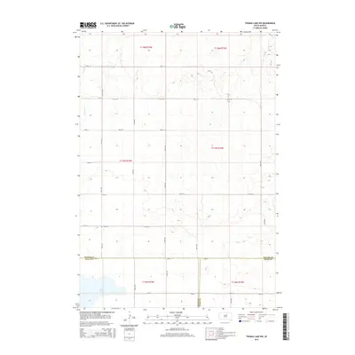
2015 Map of Thomas Lake NW
USGS Topo · Published 2015About this map
Okobojo Cr and Stone Lake anchor this rural landscape in the southern reaches of Potter County. The terrain is defined by the Public Land Survey System, with the map recording the intersection of four major townships: t118n r74w, t118n r73w, t117n r74w, and t117n r73w. This intersection of Potter, Sully, and Hyde counties represents a remote section of the South Dakota prairie during the early 21st century. The local road network follows a strict sectional grid, with numbered routes like 170th St and 323rd Ave providing access to the vast agricultural allotments. For local historians, the inclusion of Copp Cem provides a specific point of reference for early settlement and family genealogy in this sparsely populated area.
Find a feature on this map
26 named features on this map. Tap any name to fly to it.
Don’t see what you’re looking for? This feature index may not catch every label — zoom into the map to look around manually.
Map Details
Editions of this 2015 Thomas Lake NW Map
This is the sole edition of this map. No revisions or reprints were ever made.
Other maps of this area
1953 · Huron
USGS Topo · 1:250,000
1954 · Aberdeen
USGS Topo · 1:250,000
1954 · Huron
USGS Topo · 1:250,000
1956 · Aberdeen
USGS Topo · 1:250,000
1974 · Gettysburg Municipal Airport SE
USGS Topo · 1:24,000
1974 · Gettysburg Muni. Airport NE
USGS Topo · 1:24,000
1978 · Bald Hills
USGS Topo · 1:24,000
1978 · Thomas Lake
USGS Topo · 1:24,000
1978 · Thomas Lake SW
USGS Topo · 1:24,000
1978 · Seneca SW
USGS Topo · 1:24,000