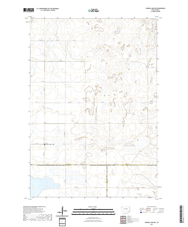
2021 Map of Thomas Lake NW
USGS Topo · Published 2021About this map
Okobojo Cr meanders through the northwest corner of this prairie landscape, defined by the convergence of three central South Dakota counties. This high plains territory is anchored by Stone Lake in the southwest, a notable water feature on the border of Potter and Sully counties. The mapping of this region reflects a structured grid of rural infrastructure, where routes like Co Rd 156 and Co Rd 807 provide access to isolated agricultural sections. For genealogists and local historians, the presence of Copp Cem situated along 171st St offers a specific point of interest for family research within this sparsely populated township framework. The survey captures the intersection of Potter, Sully, and Hyde counties, illustrating the vast pastoral layout of the Dakotas in the twenty-first century.
Find a feature on this map
30 named features on this map. Tap any name to fly to it.
Don’t see what you’re looking for? This feature index may not catch every label — zoom into the map to look around manually.
Map Details
Editions of this 2021 Thomas Lake NW Map
This is the sole edition of this map. No revisions or reprints were ever made.
Other maps of this area

1953 · Huron
USGS Topo · 1:250,000

1954 · Aberdeen
USGS Topo · 1:250,000

1954 · Huron
USGS Topo · 1:250,000

1956 · Aberdeen
USGS Topo · 1:250,000

1974 · Gettysburg Municipal Airport SE
USGS Topo · 1:24,000
1974 · Gettysburg Muni. Airport NE
USGS Topo · 1:24,000
1978 · Bald Hills
USGS Topo · 1:24,000
1978 · Thomas Lake
USGS Topo · 1:24,000
1978 · Thomas Lake SW
USGS Topo · 1:24,000
1978 · Seneca SW
USGS Topo · 1:24,000